The following steps demonstrate how to create an indoor map in your Azure Maps account using the Azure Maps Creator onboarding tool. The MapConfigurationId property is created during the onboarding process and is used to reference the map in your application. For more information, see The Map Configuration ID.
If your drawing package doesn't contain a manifest, The Drawing Package Guide describes how to create one.
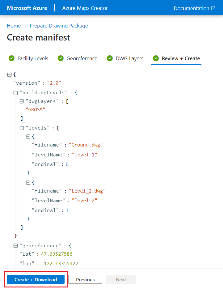
Once your drawing package has been processed, select the Create + Download button to begin creating the indoor map.
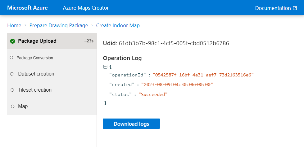
The first step in this process uploads the package into the Azure Maps account.
Once the package is uploaded, the onboarding tool uses the Conversion service to validate the data then convert the geometry and data from the drawing package into a digital indoor map. For more information about the conversion process, see Convert a drawing package in the Creator concepts article.
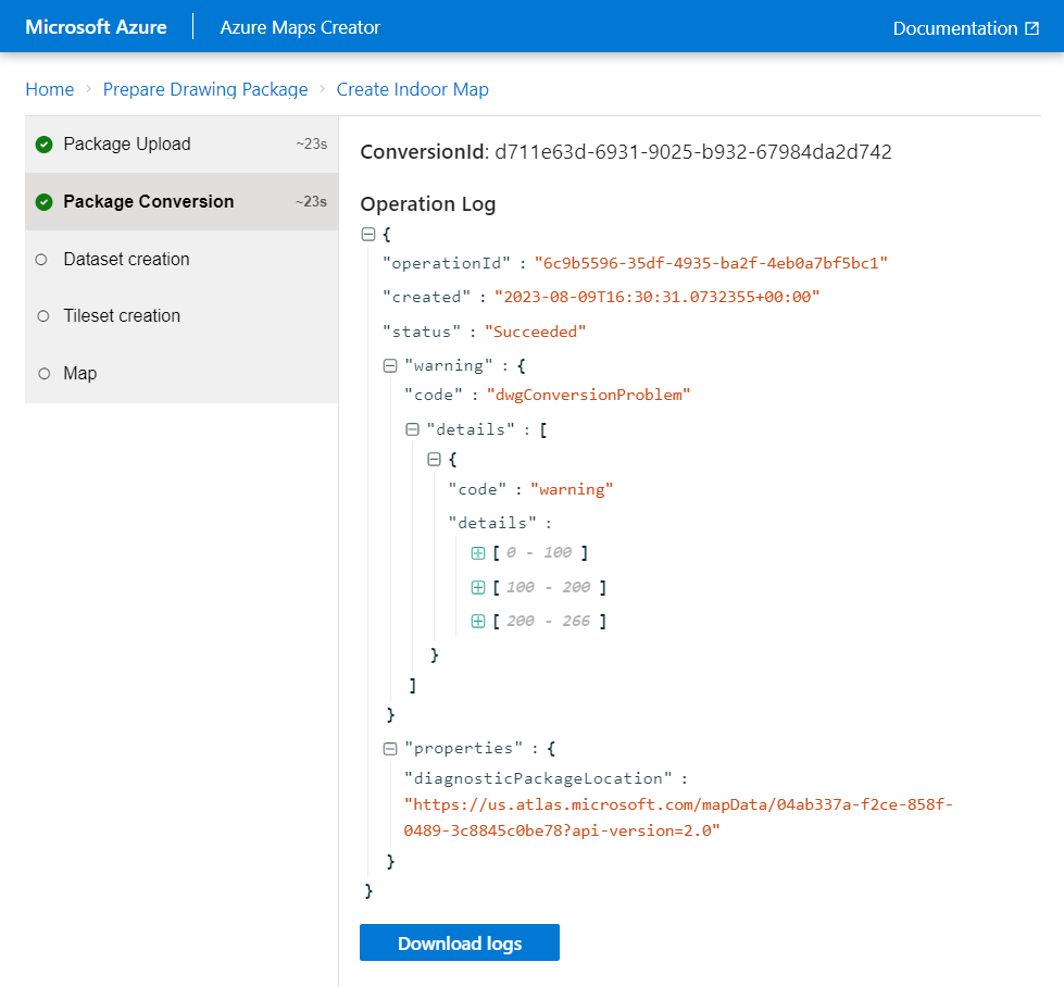
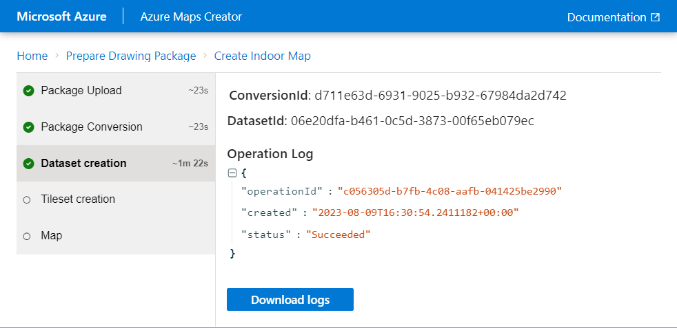
The next step in the process is to create the dataset. Datasets contain a collection of features within the facility.
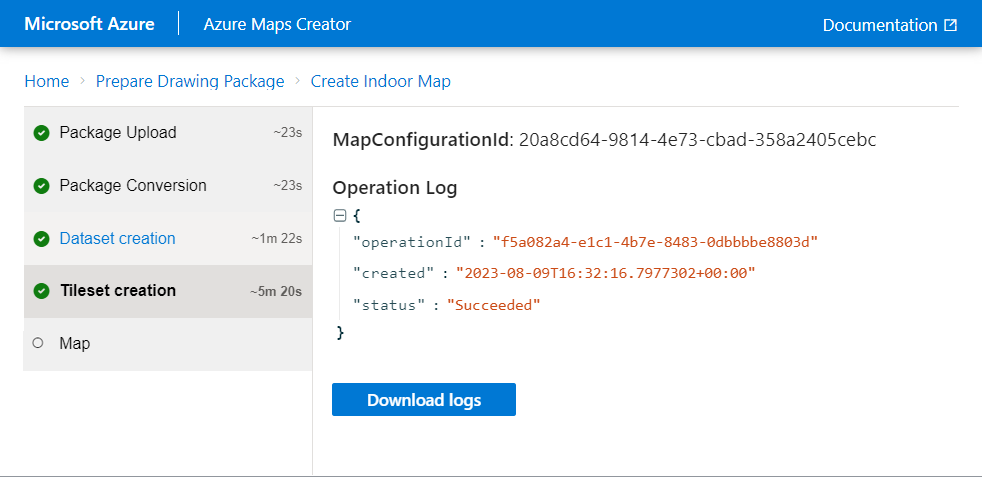
The dataset is used to create a tileset. Tilesets are a lightweight storage format used by Azure Maps when rendering map data.
Important
The MapConfigurationId is created as a part of the tileset creation process and is required to reference the indoor map in your applications. Make sure to make a copy of it for future reference.
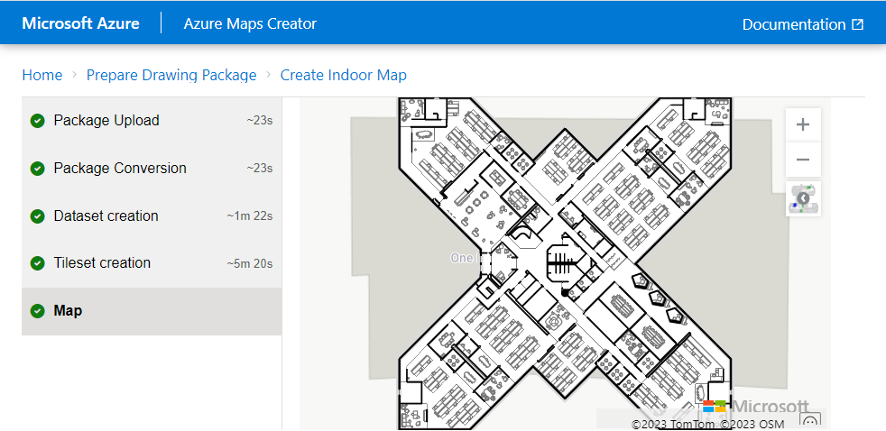
The indoor map is created and displayed as a preview.
Your indoor map is created and stored in your Azure Maps account and is now ready to be used in your applications.
The Map Configuration ID
The MapConfigurationId property created as a part of the tileset creation process in step 6. This property is required to reference the indoor map in your application code. Make sure to make a copy of it for future reference.
Next steps
Integrate the indoor map into your applications using the Web SDK.
Learn about writing code to interact with Azure Maps. Develop and test a fun app using JavaScript and Visual Studio Code to find the best route for a truck, car, or bicycle. The route is from the west coast of the USA, to the east coast. You can see how routes change based on vehicle. And, for trucks, how routes vary if the contents are hazardous. You get the chance to add in your own locations.