MapTypeId Enumeration
This enumeration is used to specify the type of map style that should be displayed by the map. It is specified as Microsoft.Maps.MapTypeId.[Name] where [Name] can be any of the following values.
| Name | Description | Example |
|---|---|---|
aerial |
The map displays aerial imagery. | 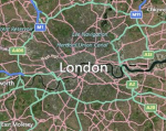 |
canvasDark |
A dark version of the road maps. | 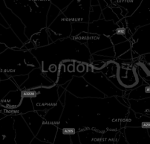 |
canvasLight |
A lighter version of the road maps which also has some of the details such as hill shading disabled. |  |
birdseye |
High resolution aerial imagery taken at 45 degrees to the ground, from 4 different directions. | 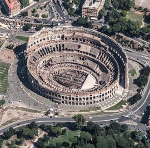 |
grayscale |
A grayscale version of the road maps. | 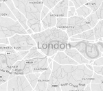 |
mercator |
The map does not display any imagery. Use this option if you want to display custom imagery instead of Bing Maps imagery. | |
ordnanceSurvey |
The map displays Ordnance Survey imagery. Ordnance Survey imagery is only available in the UK. Bing Maps provides the 1:25,000 OS Explorer Map and 1:50,000 OS Landranger maps. When the map is panned or zoomed out of range, road map imagery will be displayed. Map culture must be set to en-GB. | 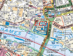 |
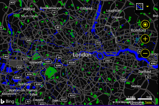
road |
The map displays road imagery. | 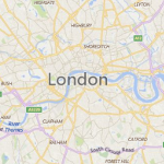 |
streetside |
Provides streetside panoramas from the street level. |  |
High Contrast Support
To make Bing Maps more accessible, high contrast support has been added. When the user’s computer is in high contrast mode, a high contrast version of the road maps will be displayed.