Windows Maps
A Microsoft app that provides voice navigation and turn-by-turn driving, transit, and walking directions.
245 questions
This browser is no longer supported.
Upgrade to Microsoft Edge to take advantage of the latest features, security updates, and technical support.
' cx='32' cy='32' r='32' /%3E%3Ctext x='50%25' y='55%25' dominant-baseline='middle' text-anchor='middle' fill='%23FFF' %3EP%3C/text%3E%3C/svg%3E)
For some days now, the quality of the BING imagery degraded. It seems as if someone applied some hardcore sharpening filter, or as I put it: a cheap artistic filter in Photoshop.
When zooming in to the highest resolution available, the new effects becomes more than obvious. In particular in rural zones with a high level of vegetation and in particular forest.
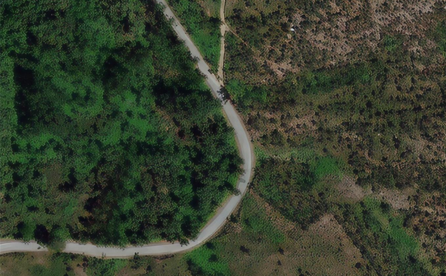
Was this a mistake? Is this imagery, which is worse than before, staying for some time with us?
This phenomenon appears globally, sometimes more accentuated, sometimes less. But it is generalized.
Compared to Google, Mapbox or Esri, BING's imagery just lost a lot of points.
Looking forward to receiving some feedback about this recent change.
Cheers

Hi @Patribus ,
Bing Maps imagery is a patchwork, stitched together like a quilt, of imagery from multiple providers. You have removed the attribution from your capture above but in the bottom corner you can usually find the supplier. There is often a tough judgement call in choosing fresher imagery that has less resolution and supporting higher resolution in urban environments over rural. This is why you will see varying imagery density in different regions. Also some areas of the world just don't have a higher resolution fly over data available for many different reasons. The imagery team partners to offer the best that we can get, balancing the costs, storage requirements and choices available. For your part, you can click the feedback button and fill in why you need higher resolution imagery in that area or even reach out to a supplier like https://www.terracolor.net/ if you need something specific.
Sincerely,
IoTGirl