Azure Maps
An Azure service that provides geospatial APIs to add maps, spatial analytics, and mobility solutions to apps.
836 questions
This browser is no longer supported.
Upgrade to Microsoft Edge to take advantage of the latest features, security updates, and technical support.
' cx='32' cy='32' r='32' /%3E%3Ctext x='50%25' y='55%25' dominant-baseline='middle' text-anchor='middle' fill='%23FFF' %3EN%3C/text%3E%3C/svg%3E)
I went through the article to process the DWG file, integrated inside ZIP file with manifest.json and .dwg files. But I am not sure how I can generate the GeoJson response from it. Can someone help me? Or how I can retrieve each shape details (like location, length, width with respect to reference point) from DWG?
' cx='32' cy='32' r='32' /%3E%3Ctext x='50%25' y='55%25' dominant-baseline='middle' text-anchor='middle' fill='%23FFF' %3EQ%3C/text%3E%3C/svg%3E)
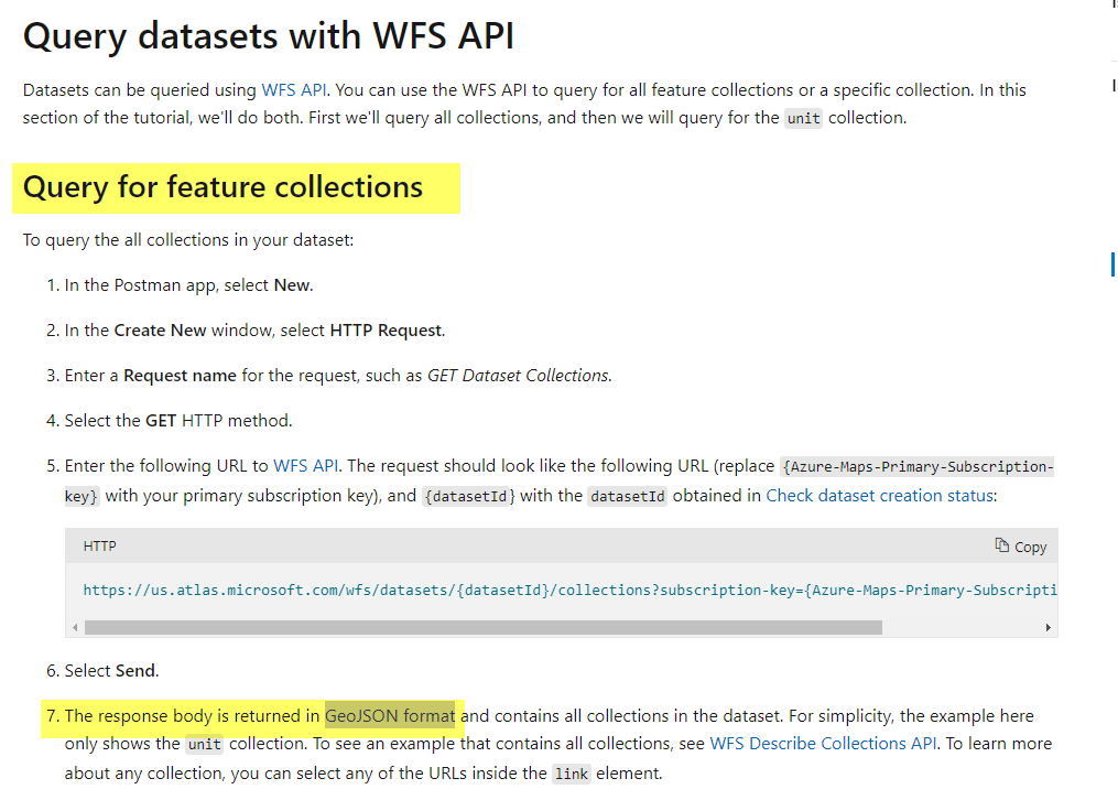
Hello @notescrew the tutorial has a 7th step for Query for feature collections. The response body is returned in a GeoJSON format and contains all collections in the dataset.
Are you looking for something directly converting DWG to GeoJSON format via Azure Maps REST API?
@QuantumCache Thanks a lot for your help, I will test it.