Azure Maps
An Azure service that provides geospatial APIs to add maps, spatial analytics, and mobility solutions to apps.
836 questions
This browser is no longer supported.
Upgrade to Microsoft Edge to take advantage of the latest features, security updates, and technical support.
' cx='32' cy='32' r='32' /%3E%3Ctext x='50%25' y='55%25' dominant-baseline='middle' text-anchor='middle' fill='%23FFF' %3EK%3C/text%3E%3C/svg%3E)
Hi team,
I'm building an app that uses the Azure Map API, however it seems that the Satellite image is out of date.
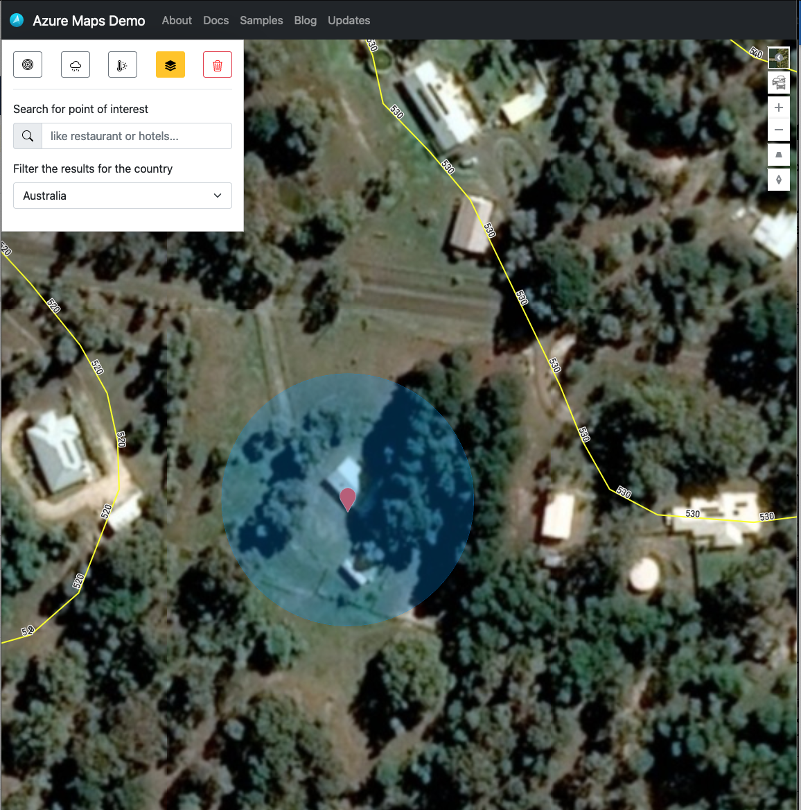
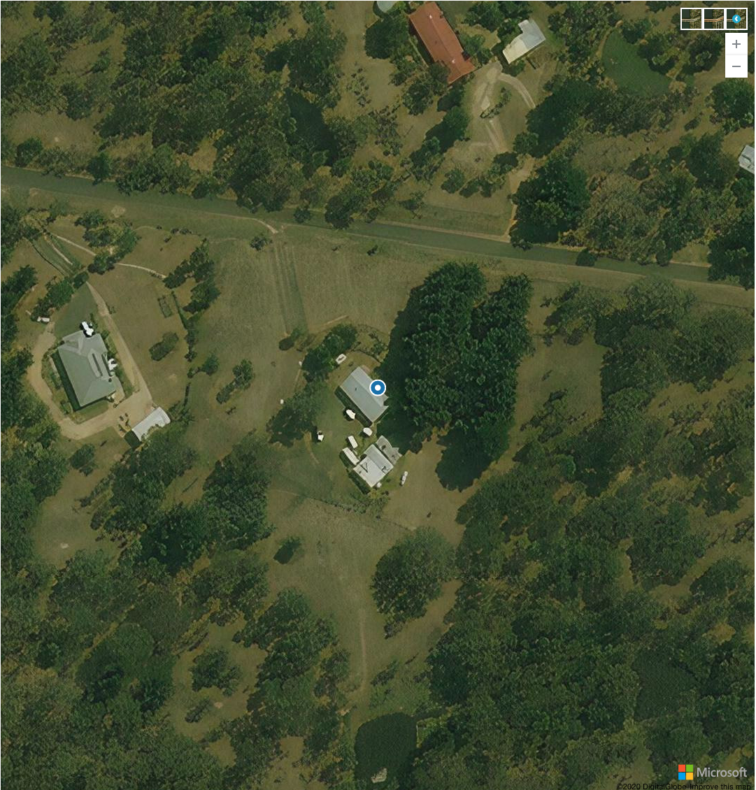
As you can see below, the first image is from the Azure maps demo is up-to-date (as compared to google maps), compared to the second image shows what is returned from the Azure Maps API.
Is there an option to ensure that the latest data is returned by default?
Satellite View from the azure maps demo
Satellite view returned from Azure maps api in my app

One thing to check. The Azure Maps Web SDK is using version 2.1 of the render map tile service: https://learn.microsoft.com/en-us/rest/api/maps/render-v2/get-map-tile If you are using version 1 of the render map tile imagery service, that may be the reason for the difference: https://learn.microsoft.com/en-us/rest/api/maps/render/get-map-imagery-tile
Hi @rbrundritt ,
You might be onto something here. I'm using react-azure-maps@0.3.0 which has a dependency on azure-maps-control@2.0.32. So this is probably the issue, let me try updating, and I'll loop back.
Cheers,
Keagan
' cx='32' cy='32' r='32' /%3E%3Ctext x='50%25' y='55%25' dominant-baseline='middle' text-anchor='middle' fill='%23FFF' %3ESC%3C/text%3E%3C/svg%3E)
Hi Keagan,
Thank you for reporting the issue. Can you please share the specific region (latitude, longitude or address) you were looking at? Please also confirm the API you were using.
Seshagiri
Hi @Seshagiri Cherukuri ,
Thanks for the reply. Am I able to direct message you the coordinates (as they refer to my personal location)?
Please also confirm the API you were using.
I am using Azure Maps Gen 2 from a react web app via react azure maps, how do I find what version of the API?
Cheers,
Keagan
@Keagan Can you just paste the URL of the service (without subscription key), it will help me determine the version. And for the location in question, can you share the city you were searching for.