Azure Maps
An Azure service that provides geospatial APIs to add maps, spatial analytics, and mobility solutions to apps.
This browser is no longer supported.
Upgrade to Microsoft Edge to take advantage of the latest features, security updates, and technical support.
' cx='32' cy='32' r='32' /%3E%3Ctext x='50%25' y='55%25' dominant-baseline='middle' text-anchor='middle' fill='%23FFF' %3EMH%3C/text%3E%3C/svg%3E)
Hi,
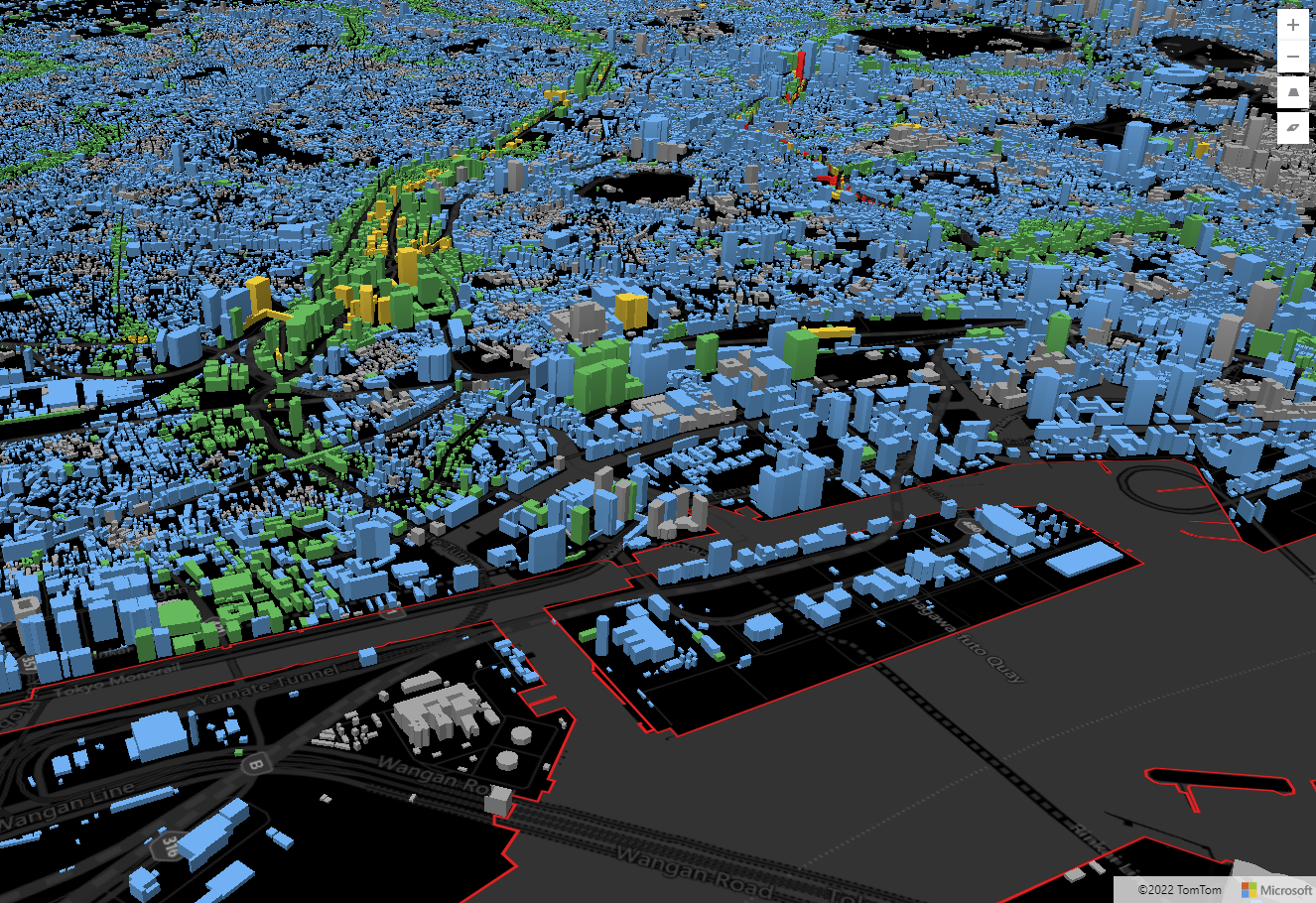
Do Azure Maps provide 3D maps? I know Satellite imagery is available; however the customer needs drone/aerial images to get the volumes of the city. I know Bing Maps already provides 3D maps of many cities in the world. Is there an equivalent of it in Azure Maps? If not, could the customer import Bing 3D to Azure?
' cx='32' cy='32' r='32' /%3E%3Ctext x='50%25' y='55%25' dominant-baseline='middle' text-anchor='middle' fill='%23FFF' %3EQ%3C/text%3E%3C/svg%3E)
Hello @Maia Henley Just checking back, could you please let us know if you need further help in this matter?
Please accept the helpful response as 'Answer', which will be helpful to others as well with similar questions.

Azure Maps currently does not provide a true 3D experience. Currently the following is achievable with Azure Maps:
1) Extrude polygons on top of a flat 2D map. This is good for data visualization type scenarios where the polygons act kind of like bar charts. I've done this with two million of building footprints in the past to create engaging experiences.
2) Overlay 3D models on top of a flat 2D map canvas and rotate/pitch the view. This can be achieved by accessing some undocumented capabilities within the map control. Here are a couple of examples:
Now, all of the above do not provide rich textured 3D city views. Currently that is only available in the Bing Maps in the following SDKs:
It's not possible to import Bing Maps 3D data into the Azure Maps SDKs at this time. It would be best to simply use one of the Bing Maps SDKs if you are looking for3D textured cities.
Thank you! This is very helpful.