A Spatially-Enabled Dinner In Austin, Texas: Some Observations Outside the Office
Not having posted for a while, I thought I'd take a few minutes and provide some thoughts on spatial after successfully negotiating dinner here in Austin, Texas (October 6, 2009). I'm in town for the Texas GIS Forum, one of my favorite conferences, and always seek out barbeque when I can. A quick check on Bing Maps verified that my hotel was very close to Rudy's Bar-B-Q. I remembered that Rudy's was on a one-way road, next to a freeway, and wanted to verify my route using Live Search on my Windows Mobile Phone. The route that it provided seemed counter-intuitive: it wanted to take me across the freeway and have me reverse my route at an overpass (see below).
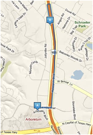 Bing Maps Route
I chose a more straight-forward route and finally coerced Live Search on my mobile to guide me that way (after repeated, "reroute from current location?" messages...). An added bonus was that Rudy's had an entrance off of my newly found route and I got there in a very direct fashion.
When I got back to the hotel, I decided to see how Google Maps handled the same route request. Google did the right thing and provided an almost ideal route (see below), though it is curious that Research Blvd, which parallels Highway 183 on both sides, is not shown - curious. It too missed the back entrance to the restaurant, but that's a minor detail.
 Google Maps Route
When I got to Rudy's, I fired up the GPS-Photo tool on my mobile phone and took a series of images.
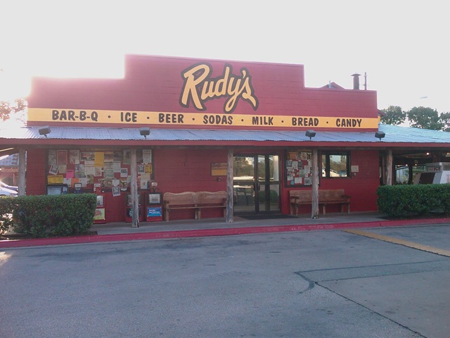 Entrance to Rudy's on Research Blvd.
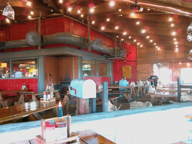
 View from parking lot
 Outdoor seating is available...
For dinner, I had the lean brisket, white bread, beans, potato salad and an IBC Cream Soda - all for $12.19. The foot was great but the beans needed some spicing up. I added a bit of their famous barbeque sauce (below) to made the beans quite tasty... It was 91 degrees outside and quite humid (from my West Coast environment viewpoint) at 6:00 PM in the evening. Perfect barbeque weather.
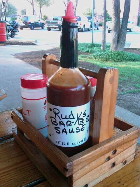 Geocoded Barbeque Sauce (latitude 30.414167, longitude: -97.7467, WGS84)
When I got back to the hotel, I loaded each of the GPS-enabled images from the mobile phone into my favorite photo application: SpatialAlbum. I'll blog more about this application at a later point, but, in short, it allows you to load GPS-enabled digital images, using a drag-an-drop interface, into SQL Server 2008. It uses a lot of SQL Server 2008 goodies: spatial, sparse columns, filestreams, the new datetime2 type and overlays all spatial data on top of Bing Maps.
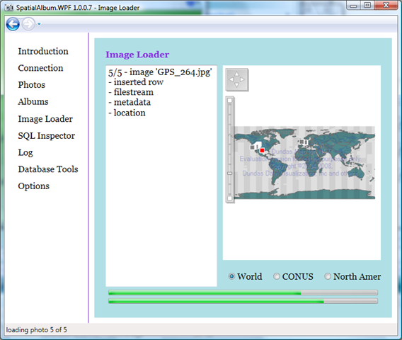 SpatialAlbum application
Here is the location of the photos I took using the Bing Maps feature of SpatialAlbum:
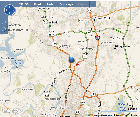 Rudy's location on Bing Maps
The following are some Bing Maps displays in SpatialAlbum showing various view/featues:
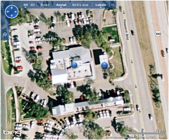 Synoptic view in the Aerial mode
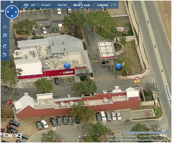 Bird's eye view from the south
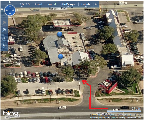 Bird's eye view showing back entrance...
 Bird's eye view from the north showing parking lot
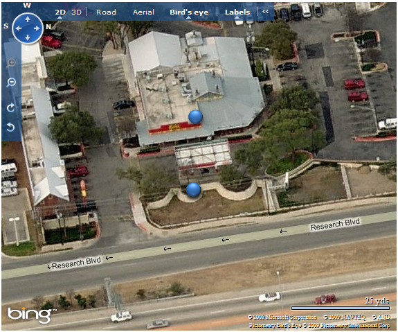 Bird's eye view of the main entrance off Research Blvd.
And there you have it - more information than you ever wanted on an obscure topic. Maybe I should do a WikiPedia page on Rudy's...
Technorati Tags: SQL Server 2008 R2,spatial,sparse columns,datetime2,filestream,Bing Maps,Google Maps,Bird's eye,SpatialAlbum,Austin,Texas,Rudy's,barbeque,IBC,Texas GIS Forum