geo_point_to_geohash()
計算地理位置的地理hash 字串值。
深入瞭解 地理hash。
語法
geo_point_to_geohash(經度,緯度,[ 精確度 ])
深入瞭解 語法慣例。
參數
| 姓名 | 類型 | 必要 | 描述 |
|---|---|---|---|
| 經度 | real |
✔️ | 地理空間座標,以度為單位的經度值。 有效值為實數,且範圍 [-180, +180]。 |
| 緯度 | real |
✔️ | 地理空間座標,以度為單位的緯度值。 有效值為實數,且範圍 [-90, +90]。 |
| 準確性 | int |
定義要求的精確度。 支援的值位於範圍 [1, 18]。 如果未指定,則會使用預設值 5 。 |
傳回
具有要求正確性長度之指定地理位置的地理hash 字串值。 如果座標或精確度無效,查詢會產生空的結果。
注意
- Geohash 可以是實用的地理空間叢集工具。
- Geohash 有 18 個精確度等級,面積覆蓋範圍從最高層級 1 到 0.6 公里 1 到 0.6 μ 18 級不等。
- 地理哈希的常見前置詞表示彼此點的鄰近性。 共用前置詞越長,兩個位置越近。 精確度值會轉譯為地理混搭長度。
- Geohash 是平面表面的矩形區域。
- 在 以經度 x 和緯度 y 計算的地理hash 字串上叫用 geo_geohash_to_central_point() 函式不一定傳回 x 和 y。
- 由於地理哈什定義,兩個地理位置可能彼此非常接近,但有不同的地理hash 代碼。
每個精確度值的地理hash 矩形區域涵蓋範圍:
| 正確性 | 寬度 | 高度 |
|---|---|---|
| 1 | 5000 公里 | 5000 公里 |
| 2 | 1250 公里 | 625 公里 |
| 3 | 156.25 公里 | 156.25 公里 |
| 4 | 39.06 公里 | 19.53 公里 |
| 5 | 4.88 公里 | 4.88 公里 |
| 6 | 1.22 公里 | 0.61 公里 |
| 7 | 152.59 m | 152.59 m |
| 8 | 38.15 m | 19.07 公尺 |
| 9 | 4.77 公尺 | 4.77 公尺 |
| 10 | 1.19 m | 0.59 m |
| 11 | 149.01 公厘 | 149.01 公厘 |
| 12 | 37.25 公厘 | 18.63 公厘 |
| 13 | 4.66 公厘 | 4.66 公厘 |
| 14 | 1.16 公厘 | 0.58 公厘 |
| 15 | 145.52 μ | 145.52 μ |
| 16 | 36.28 μ | 18.19 μ |
| 17 | 4.55 μ | 4.55 μ |
| 18 | 1.14 μ | 0.57 μ |
另 請參閱geo_point_to_s2cell()、 geo_point_to_h3cell()。
如需與其他可用網格系統的比較,請參閱地理空間叢集與 Kusto 查詢語言。
範例
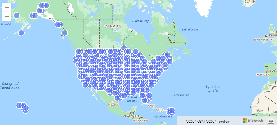
下列範例會尋找由 geohash 匯總的美國風暴事件。
StormEvents
| project BeginLon, BeginLat
| summarize by hash=geo_point_to_geohash(BeginLon, BeginLat, 3)
| project geo_geohash_to_central_point(hash)
| render scatterchart with (kind=map)
輸出
下列範例會計算並傳回 geohash 字串值。
print geohash = geo_point_to_geohash(-80.195829, 25.802215, 8)
輸出
| geohash |
|---|
| dhwfz15h |
下列範例會尋找座標群組。 群組中的每個座標組都位於矩形區域 4.88 公里到 4.88 公里。
datatable(location_id:string, longitude:real, latitude:real)
[
  "A", double(-122.303404), 47.570482,
  "B", double(-122.304745), 47.567052,
  "C", double(-122.278156), 47.566936,
]
| summarize count = count(),                                          // items per group count
            locations = make_list(location_id)                        // items in the group
            by geohash = geo_point_to_geohash(longitude, latitude)    // geohash of the group
輸出
| geohash | 計數 | 位置 |
|---|---|---|
| c23n8 | 2 | [“A”, “B”] |
| c23n9 | 1 | ["C"] |
下列範例會產生空的結果,因為座標輸入無效。
print geohash = geo_point_to_geohash(200,1,8)
輸出
| geohash |
|---|
下列範例會產生空的結果,因為精確度輸入無效。
print geohash = geo_point_to_geohash(1,1,int(null))
輸出
| geohash |
|---|
意見反應
即將登場:在 2024 年,我們將逐步淘汰 GitHub 問題作為內容的意見反應機制,並將它取代為新的意見反應系統。 如需詳細資訊,請參閱:https://aka.ms/ContentUserFeedback。
提交並檢視相關的意見反應