Azure Maps
An Azure service that provides geospatial APIs to add maps, spatial analytics, and mobility solutions to apps.
837 questions
This browser is no longer supported.
Upgrade to Microsoft Edge to take advantage of the latest features, security updates, and technical support.
' cx='32' cy='32' r='32' /%3E%3Ctext x='50%25' y='55%25' dominant-baseline='middle' text-anchor='middle' fill='%23FFF' %3EHS%3C/text%3E%3C/svg%3E)
I would like to show the Western Sahara on my report, but unfortunately, the visual Azure Maps does not recognise this country, despite it is a UN country.
Is the problem with the visual ?

I'm not on the Azure Maps team, but I suspect the reason is that "Western Sahara" is a disputed territory, and thus, its visibility on the map would vary based on the maps view option setting which is used to modify how the map displays disputed items on the map (place names, borders...). Most code samples for Azure Maps set the view to Auto which will align the view based on the user's location in the world (based on IP address). So, if a user is within the "Western Sahara" area, they will most likely see it appear on the map. Alternative, I believe if you can set the view option to anything but MA (the Moroccan view) the label appears https://learn.microsoft.com/en-us/azure/azure-maps/supported-languages#azure-maps-supported-views Note that you might have to zoom in a bit closer since it isn't a country label, but an Admin District 1 label (it appears at zoom level 4).
Also, the UN recognizes "Western Sahara" as a "Non-Self-Governing Territory", not a country: https://www.un.org/dppa/decolonization/en/nsgt/western-sahara
Also, worth noting a word of caution. If you override the Auto setting, be careful showing the map outside of the region you manually specified for the view. Some countries have very serious consequences for those businesses or individuals who widely display maps that don't align with their regional views.
Hi, thank you very much for your answers.
I reviewed the options of the map and found that only the new feature "Filled map" is not recognising the Western Sahara.

This was reported to our provider Tomtom and I believe they have implemented a fix. Can you confirm?
Hi,
Thank you for your response.
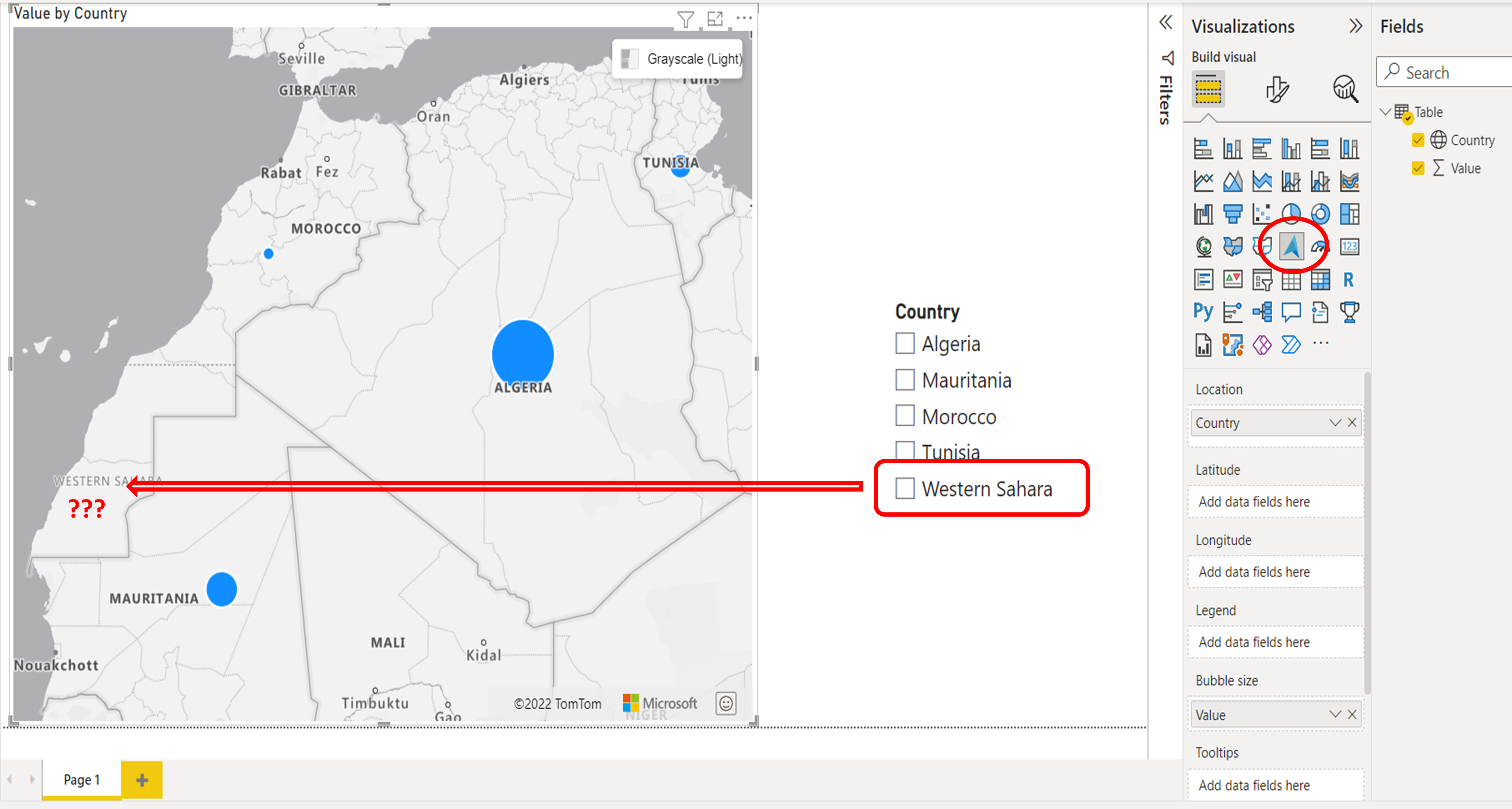
As you can see in the attached picture, the Western Sahara is still not recognised by the Azure Map.
When we use the filled map feature, the Western Sahara is recognised as Morocco !