Enable automatic address geocoding
Geocoding is the process of transforming text-based address descriptions into geographical coordinates. Dynamics 365 Field Service coordinate to estimate travel times when scheduling a work order to a resource.
The Auto Geo Code Addresses setting enables the system to automatically get coordinates (latitude and longitude) based on the address of a service account or a resource.
Prerequisites
To use geocoding or location services, you need to enable on maps. For more information, see Connect to maps.
Enable automatic geocoding
Open the Field Service app.
Change to the Settings area and go to Administration, and then choose Field Service Settings.
In Other tab, set Auto Geo Code Addresses to Yes.
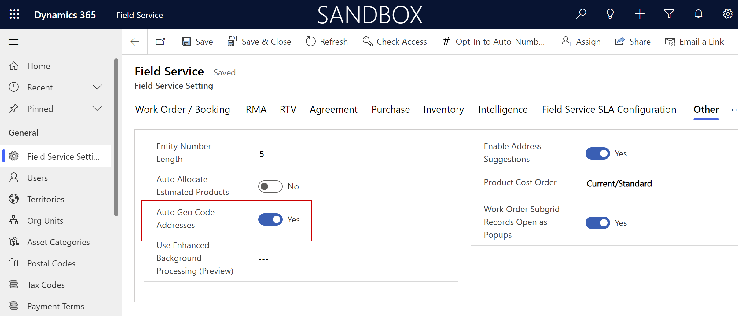
Select Save.
The geocoding process in Field Service uses only one street field (Street1). Additional information like apartment number in Street2 and Street3 is ignored. Don't add the extended information to Street1. The string length could be too long to process.
Tip
When the system finds no geocode match, it returns the value (0,0). Any custom logic that uses geocoding should ignore these results to avoid incorrect locations and travel routes.
Get coordinates for an address on a record
Open a work order or a service account.
Ensure the address is accurate.
On the command bar, select Geo Code.
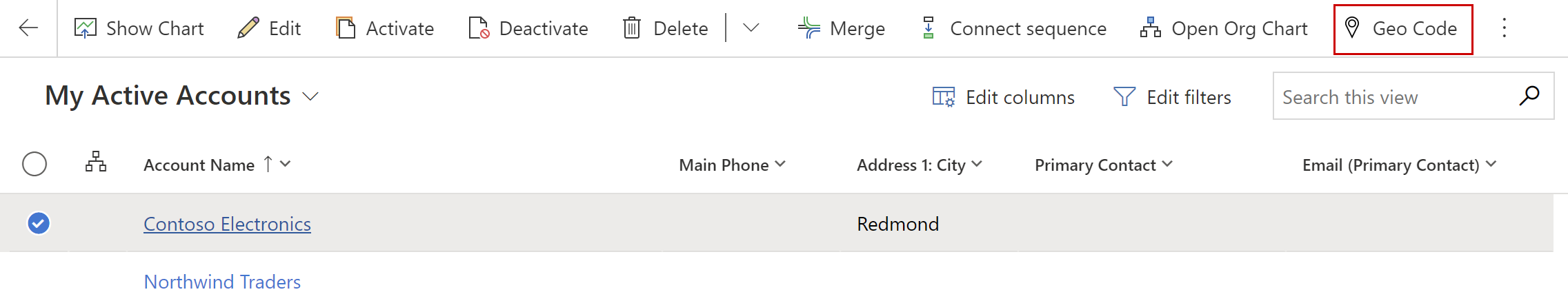
On the map dialog box, make sure you have the correct address, and then select Change.
Feedback
Coming soon: Throughout 2024 we will be phasing out GitHub Issues as the feedback mechanism for content and replacing it with a new feedback system. For more information see: https://aka.ms/ContentUserFeedback.
Submit and view feedback for