Nóta
Aðgangur að þessari síðu krefst heimildar. Þú getur prófað aðskrá þig inn eða breyta skráasöfnum.
Aðgangur að þessari síðu krefst heimildar. Þú getur prófað að breyta skráasöfnum.
Tenant settings control whether members of your organization can use Map items. Administrators can enable or disable this feature to allow or restrict access. If enabled, users can create, view, and interact with Map items in their Fabric environment. If disabled, Map item functionality is unavailable to all users in the tenant.
Fabric includes three tenant settings that determine whether Azure Maps services are available in Map items and Map visuals. These settings affect user access to map-powered features, including Map items and Map visuals within notebooks.
Access to Azure Maps Services
When the Users can use Azure Maps services setting is enabled, users can access both the Map item and the Map visual in notebooks. These features, powered by Azure Maps, allow users to create location-aware reports, monitor real-time telemetry, and explore spatial data directly within Fabric.
This setting determines whether members of your organization, or specific security groups, can access Azure Maps-powered experiences within Fabric. When enabled, users can utilize features such as Interactive Maps and geospatial analytics across Fabric components like Map items, Map visuals, and notebooks. Disabling this setting restricts access to these location-aware capabilities, helping administrators manage data usage and compliance based on organizational needs.
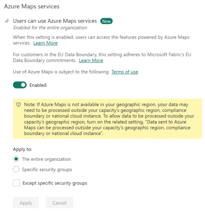
Default: Enabled
Note
Even when this setting is turned off, users can still open Map items. In this limited experience, the map background is blank because Azure Maps basemaps aren't available, but added data layers continue to display. Turn the setting back on to restore the full Azure Maps experience.
Configure global data processing
The Data sent to Azure Maps can be processed outside your capacity's geographic region, compliance boundary or national cloud instance setting is relevant only for customers who plan to use Map items and Map visuals in notebooks powered by Azure Maps, and whose capacity's geographic region is outside the supported Azure Maps service regions.
When enabled, this setting allows data sent to Azure Maps to be routed to the nearest available region, which may reside outside your organization's compliance boundary or national cloud instance. This ensures uninterrupted access to Azure Maps capabilities in unsupported regions.
Note
This setting alone does not enable Azure Maps. You must also enable the setting Users can use Azure Maps services.
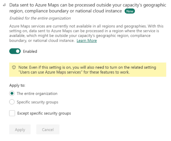
Default: Disabled
Note
If your capacity's geographic region isn't a supported Azure Maps region and you disable this setting, users can still open Map items in a limited experience. The map displays a blank background instead of an Azure Maps basemap, but added data layers remain visible. Re-enable this setting to restore the full Azure Maps experience.
Note
Azure Maps does not process or transmit any customer names or personally identifiable information (PII).
Access to Azure Maps Weather Services (Preview)
The Users can use Azure Maps Weather Services (Preview) setting controls whether users can access weather data in Map experiences that use Azure Maps Weather, sourced from AccuWeather.
This setting is relevant only for organizations that already use Azure Maps-powered features in Fabric. It doesn't turn on Azure Maps by itself. To use Azure Maps Weather Services, you must also enable Users can use Azure Maps services.
For more information, see Azure Maps Weather services.