MapTypeId Enumeration
Note
Bing Maps Web Control SDK retirement
Bing Maps Web Control SDK is deprecated and will be retired. Free (Basic) account customers can continue to use Bing Maps Web Control SDK until June 30th, 2025. Enterprise account customers can continue to use Bing Maps Web Control SDK until June 30th, 2028. To avoid service disruptions, all implementations using Bing Maps Web Control SDK will need to be updated to use Azure Maps Web SDK by the retirement date that applies to your Bing Maps for Enterprise account type. For detailed migration guidance, see Migrate from Bing Maps Web Control SDK and Migrate Bing Maps Enterprise applications to Azure Maps with GitHub Copilot.
Azure Maps is Microsoft's next-generation maps and geospatial services for developers. Azure Maps has many of the same features as Bing Maps for Enterprise, and more. To get started with Azure Maps, create a free Azure subscription and an Azure Maps account. For more information about azure Maps, see Azure Maps Documentation. For migration guidance, see Bing Maps Migration Overview.
This enumeration is used to specify the type of map style that should be displayed by the map. It is specified as Microsoft.Maps.MapTypeId.[Name] where [Name] can be any of the following values.
| Name | Description | Example |
|---|---|---|
aerial |
The map displays aerial imagery. | 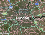 |
canvasDark |
A dark version of the road maps. | 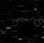 |
canvasLight |
A lighter version of the road maps which also has some of the details such as hill shading disabled. | 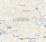 |
birdseye |
High resolution aerial imagery taken at 45 degrees to the ground, from 4 different directions. | 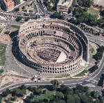 |
grayscale |
A grayscale version of the road maps. | 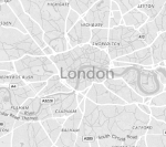 |
mercator |
The map does not display any imagery. Use this option if you want to display custom imagery instead of Bing Maps imagery. | |
ordnanceSurvey |
The map displays Ordnance Survey imagery. Ordnance Survey imagery is only available in the UK. Bing Maps provides the 1:25,000 OS Explorer Map and 1:50,000 OS Landranger maps. When the map is panned or zoomed out of range, road map imagery will be displayed. Map culture must be set to en-GB. | 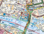 |
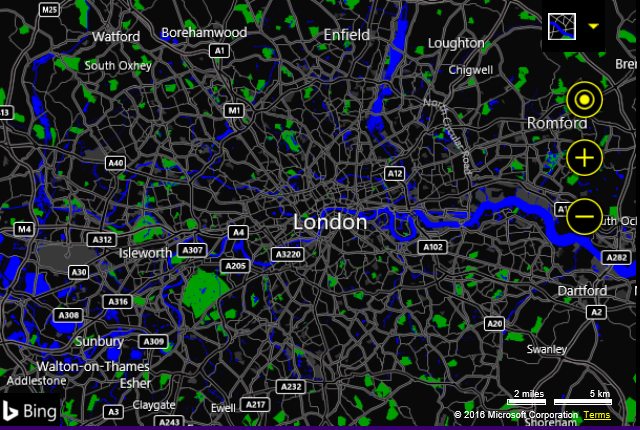
road |
The map displays road imagery. | 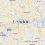 |
streetside |
Provides streetside panoramas from the street level. | 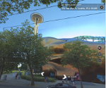 |
High Contrast Support
To make Bing Maps more accessible, high contrast support has been added. When the user’s computer is in high contrast mode, a high contrast version of the road maps will be displayed.