Customize Map Options on Load Example
Note
Bing Maps Web Control SDK retirement
Bing Maps Web Control SDK is deprecated and will be retired. Free (Basic) account customers can continue to use Bing Maps Web Control SDK until June 30th, 2025. Enterprise account customers can continue to use Bing Maps Web Control SDK until June 30th, 2028. To avoid service disruptions, all implementations using Bing Maps Web Control SDK will need to be updated to use Azure Maps Web SDK by the retirement date that applies to your Bing Maps for Enterprise account type. For detailed migration guidance, see Migrate from Bing Maps Web Control SDK and Migrate Bing Maps Enterprise applications to Azure Maps with GitHub Copilot.
Azure Maps is Microsoft's next-generation maps and geospatial services for developers. Azure Maps has many of the same features as Bing Maps for Enterprise, and more. To get started with Azure Maps, create a free Azure subscription and an Azure Maps account. For more information about azure Maps, see Azure Maps Documentation. For migration guidance, see Bing Maps Migration Overview.
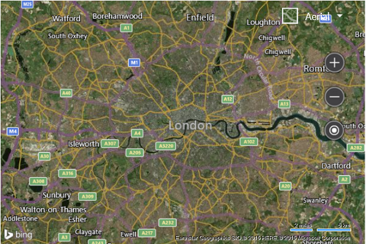
You can customize the map as you load it. Use the following code to update how the map is loaded in the GetMap function such that it sets the type to aerial, the zoom level to 10, and the map center over London, UK (51.50632, -0.12714).
var map = new Microsoft.Maps.Map('#myMap', {
    credentials: 'Your Bing Maps Key',
    center: new Microsoft.Maps.Location(51.50632, -0.12714),
    mapTypeId: Microsoft.Maps.MapTypeId.aerial,
    zoom: 10
});
This results in the map being loaded, zoomed in over London, UK with the aerial imagery displayed.